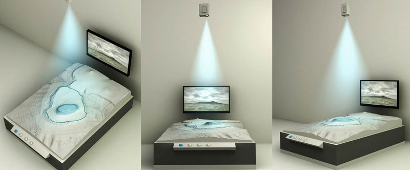
A typical application is 3D projection onto physical landscape and relief models. These scale-accurate 3D terrain models are usually created on the basis of digital geodata and a derived 3D computer model, either precisely milled from PU foam or manufactured from plastic using 3D printing technology.
The projector-based mapping onto the 3D model is precisely matched to the represented section of terrain and enriched with static or animated projection content. Typical content includes find distributions, historical battle movements, archaeological features, or points of interest and tourist destinations within the respective region.
In many cases, combining the installation with interactive touch panels is ideal, allowing the content to be controlled dynamically and in a user-driven manner.
Click on the respective image to learn more about the individual project…
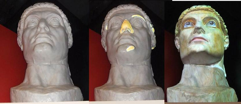
Alternatively, existing three-dimensional objects can also be presented using 3D projector mapping. For this purpose, the object surface is first digitized by means of a 3D scan and reproduced as a virtual 3D model.
Subsequently, software is used to calculate how images and animations can be projected onto the complex surface with a precise fit, minimal distortion, and consistent visual alignment on all sides—if required, using multiple projectors from different positions.
Using this method, high-resolution, depth-sharp, and precisely masked content was projected onto the milled model of the Head of Constantine. Via an interaction terminal, content such as damage visualizations or reconstructed color schemes can be accessed.
In addition, the object responded interactively to visitor movement: when a specific area of the room was entered, the eyes of Constantine moved—a deliberately playful effect with a high level of visitor response.
3D projection is particularly well suited for archaeological monuments (e.g. ancient sculptures, pediment figures, or funerary monuments) whose original coloration has been lost, as it allows for clear visualization of color reconstructions.
Creation of digital terrain and 3D models as a basis for physical model construction
➼ see 3D surveying and laser scanning
Production of relief and landscape models (CNC-milled or 3D-printed)
➼ see 3D printing and model-making services
3D digitization of existing objects for projection mapping
➼ see object scanning
Concept development, design, and production of projection content (static & animated)
➼ see multimedia services
Planning, setup, and calibration of projection software and hardware
➼ developing of plug-and-play solutions
Delivery, installation, and commissioning of the complete media technology
➼ e.g. computers, displays, projectors, etc.
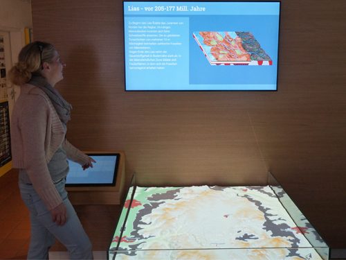
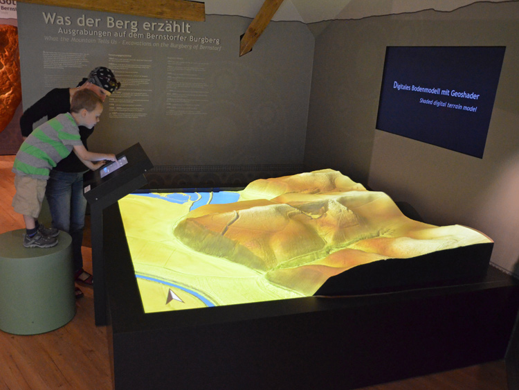
In the example shown here of the Bernstorf hilltop settlement, an airborne laser scan created by us was transformed into a highly precise, scale-accurate, and slightly exaggerated 3D terrain model of the Bronze Age hilltop site.
Using an interactive touchscreen monitor, a wide range of information and map layers can be selected, including soil quality maps, historical maps, excavation areas, wall alignments, find locations, and geophysical survey data.
At the same time, the monitor displays in-depth content, visualizations, and reconstructions that clearly convey the former Bronze Age appearance of the settlement.