We carry out archaeological “Airborne Laser Scanning” (short: ALS, also called LiDAR – “Light Detection And Ranging”) in helicopters from our partner company or with our own light aircrafts.
This ensures the required point density of app. 20 laser measuring points per square meter. The recordings themselves have a standard accuracy of about or under one decimeter. The absolute accuracy is app. 10-15 cm in position and altitude, whereas the relative accuracy can be enhanced up to 2-5 cm by different software algorithms.
High-quality technology components are installed on the aircrafts (GPS, inertial system, airborne laser scanner). They determine the exact position of the aircraft in three-dimensional space and can record and manage up to 160,000 3D laser measurements per second. The pilot himself is led precisely through the research area by a flight guidance system. That way, he can systematically cover the area in overlapping stripes. During the survey flight, the 3D laser scanner generates several hundred million measuring points in a very short time. The survey is based on the “speed of light”: the time difference between sent and reflected laser beam.
Depending on the requirements, the survey flight can be supplemented and intensified with special high-resolution cameras, e.g. RGB-orthophotographs, thermal images, infrared or spectral recordings. Multisensor-technologies currently offer new and exciting research approaches!
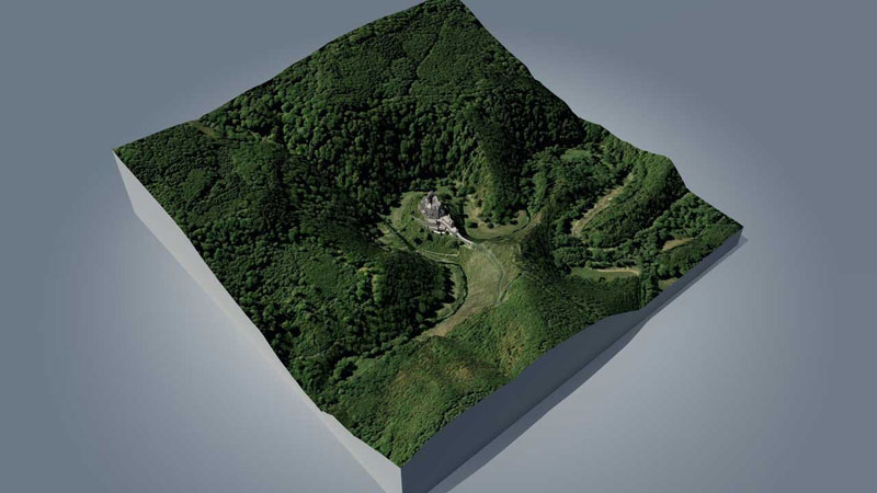
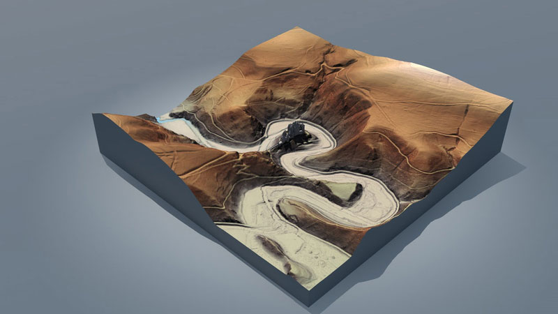
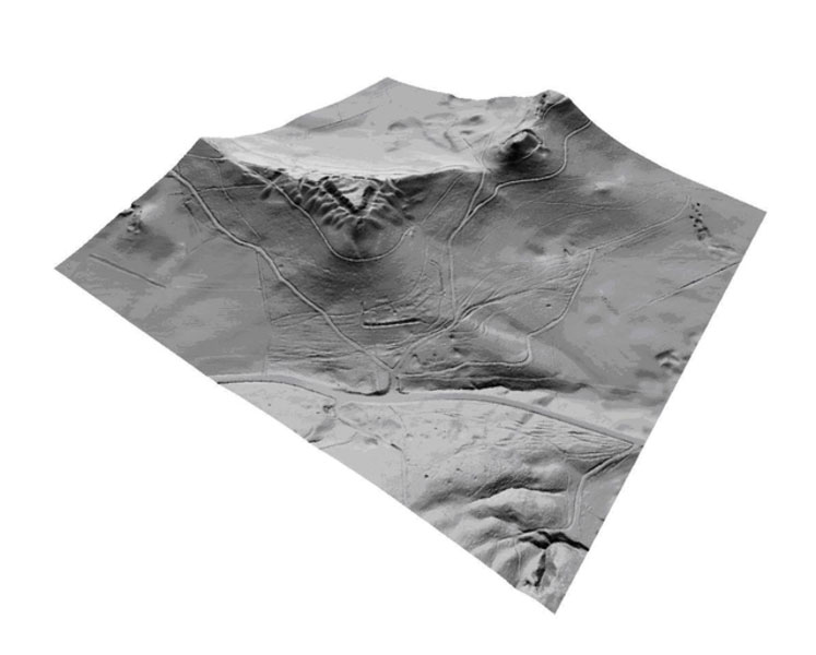
The systematical deployment of this prospection method revolutionizes archaeological approaches, especially in forests. Due to the long penetration depth of the laser scan, the pulsed laser beams penetrate tree branches and reach the ground. Therefore it is possible to filter out vegetation – especially trees and underwood vegetation – and reveal the underlying, covered landmarks, burial mounds, old acre systems, paths, and much more, in computer models.
Laser scanning flights are usually carried out in times of low vegetation, i.e. late fall, winter and beginning of spring. However, the windows of opportunity can be short. Ideally, rainstorms should compress the fallen leaves on the ground in the late autumn. Then only when the forest is completely snow free, or in the early springtime when the snow has all melted away, are further survey flights advisable. At that point, however, there are generally only a few weeks left before the vegetation starts growing again.
ALS provides various opportunities for innovative archaeological results. Archaeological structures are almost exclusively preserved in forests, which have been spared by intensive agricultural usage and leveling. ALS allows to visualize many findings for science and public; findings, which – up to now – could not be accurately located or recognized and categorized within the dense forest.
During data evaluation, a number of complex filtering methods are used to visualize archaeological structures more explicitly. The recognized findings have to be checked in the field concerning identification and significance.