
Epic Games RealityScan
RealityScan for businesses
Official Epic Games Partner for Sales, Licensing & Consulting
RealityScan new software release 2.0 aims for photogrammetry-, SFM- and 3D specialists requiring the highest precision and speed.
Create a 3D model with images, laser scans, UAVs, or synchronized camera rigs
… and mix different inputs to create a visually consistent triangular 3D model. No restrictions.
New features as well as improvements in RealityScan 2.0 :
- AI masking (automatically remove background elements)
- More intelligent alignment
- Supporting LiDAR to combine with ground data
- Quality analysis with visual heat maps
- Improved texturing speed
- Relative paths for input files
- Scale depth maps on export
- Mask layer in texturing
- Option to create non-watertight models
- Export COLMAP files
- Export DSM and DTM as 16-bit PNG files
- Larger UV islands with texture defragmentation
- Higher bit depth support for photoconsistency texturing
- Export in USD or USDZ format
- Display reconstruction region widget after activating the “Cut by Box” tool
- Export normal maps with GLB format
- Export radiance fields transformation file
Label layer image validation - Group inputs by their paths in the 1Ds view for a clearer overview [beta]
Previouse updates included:
- Up to 2x faster Reconstruction
- Up to 3x faster Texturing
- Mosaicing-based UV Unwrap and Texturing (Experimental)
- Improved one-click model generation
- Direct upload to Nira
- Improvements to a renderer for showing large models in the 3D viewport*
- Faster mesh calculation**
- RealityScan Online Help Section link
- Improvements and fixes for a seamless transition to Unreal Engine and speed-ups in the reconstruction process**
*dependent on GPU VRAM
**up to 25% speed-up in the mesh reconstruction process
RealityScan - unique in every regard
The photogrammetry software RealityScan is extremely fast, has a highly modern and innovative core and a number of unique features – a power package that is changing the industry!
Go beyond the 3D limits of what can be achieved with photogrammetric methods with amazing speed, quality and accuracy at low computer hardware usage. Registering images, calculating meshes, texturing, parallel projections, DSM, geo-referencing and coordinate system conversion are just a fraction of what you get with RC.
Laser & photos
Laser scanning meets state-of-the-art photogrammetry – all in one package. Laser scanners are natively supported within the application and are also fully involved during the position estimation of a camera or laser scanner. This results in truly unbeatable accuracy.
- Reconstruction of missing parts with the help of photos
- Automatic filtering of moving objects
- Automatic processing of registered/unregistered laser scans and/or photos
- Improving and simplifying the registration of laser scans using photos and/or checkpoints
Analysieren & Fortsetzen
Super-fast design mode that aligns 500×12 megapixel images in less than 10 minutes on a notebook, right on the spot. Combine all types of data – images, laser scans, aerial photos…
Analyze directly on site and get what you need efficiently.
- Take photos and add them to a project
- Click on draft alignment
- Review the result
- Repeat steps 1-3 until the desired result is achieved.
Create 3D models from photos, combine them with drone images and laser scan data for a fast and high-quality result! Create virtual reality scenes, textured 3D meshes, orthographic projections, geo-referenced maps and much more from images and/or laser scans completely automatically with the photogrammetry software RealityScan.
Function - Highlights
RealityScan 2.0 brings significant updates: from AI-assisted masking mode, alignment improvements and visual quality investigation to support for airborne laser scanning.
In previous versions processes have been continuously optimized for faster calculations — more specifically for depth maps. The new UserInterface UI enhances the functionality by switching to ribbon based navigation corresponding to the context of your active window — 2D, 3D, Help, etc. It’s a step-by-step walkthrough of the calculation process, while being able to refine and troubleshoot within each step. Also, some new troubleshooting tools are detecting misaligned cameras, visually seeing camera position uncertainties and controlling LODs (level of details).
Work effectively and isolate and calculate volumes and areas, view contours and create elevation profiles, calculate and export contour lines and cross sections, enable slope shading in terrain etc.
Key highlights of version 2.0:
- AI masking to automatically remove backgrounds
- More intelligent image alignment
- Combine LiDAR data and aerial images with ground data
- Quality analysis using visual heat maps
Distinctive Features:
- Faster model reconstruction and texturing
- Improved one-click model generation
- Mosaicing-based texturing and UV unwrap (Experimental)
- Direct upload to Nira
- Axis and transformation adjustment on import model dialog
- Updated resource cache behavior
- Support for PLY model import
- HEIC decoder metadata added
- Added render mesh from custom position – CLI commands + reporting system functions
- Added large triangle unwrap option to the level of detail export
- Revision of Inspection tool
And much more!
Contours
Create e.g. iso-lines on your terrain model
Cross Sections
Quickly and easily create cross sections
Cross Sections
You can also isolate cross sections
Mosaicking
Create mosaics on your digital terrain surface
Drawing Polygones
Like in GIS, trace the 3D area on an orthophoto and export the shape.
Elevation Profiles
Create elevation profiles and calculate the selected area (area calculation)
Profile Measurements
Example: display excavation profiles with a line
Display profile measurement
Display profile measurement
Color Corrections
Match and optimize true to original colors
Volume Measurements
Calculate volume of selected areas
Volume in 3D
Calculate cut and fill volume
AI masking
RealityScan interprets your object and separates it cleanly from the rest of the scenery to optimize your workflows from the captured photos to the final reconstruction data.
Smarter alignment
New default settings improve image alignment. Greater model consistency and fewer manual touch-ups.
LiDAR data support
Combine LiDAR data and aerial imagery with ground data to create accurate orthographic projections, maps and 3D models.
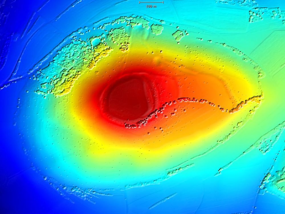
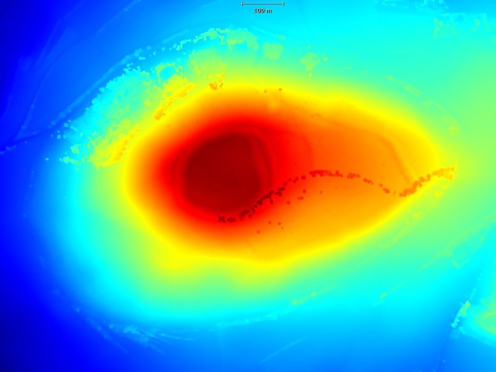
Quality analysis
Visual heatmaps allow you to identify areas that need more data before proceeding to the meshing step.
Ortho Projection using Image mosaicking
Option to create an ortho projection rendered from images rather than textured/colorized mesh.
Orthomosaic Editing
Allows to select a region and specify which cameras should be used for the orthomosaic generation – to fix possible visual issues, remove cameras that captured a moving car/person you don’t want in the orthomosaic.
Profile Measurements
Definition and elevation profile display of a drawn polyline/shape, identity of high and low points within the selected area.
Volume Measurements
Select a region, specify the base plane type and measure cut and fill volumes – useful for topographical surveys, identifying how much groundwork needed to level an area, as well as stockpile measurements.
Contours
Ability to display contours(isolines) to visualize the height profile of the displayed orthographic projection – users are able to set the min and max altitude and contour intervals. Giving a visual representation of how the land is falling and where the high and low points are – useful for topographical surveys and engineering workflows.
Cross Sections
Cross sections are mainly used within GIS workflows – they basically provide you with multiple profiles of an area along a specified plane – these can then be exported as shapefile/dxf format.
Cut by Box
Allows to remove triangles inside/outside box or slice.
Misalignment Detection Tool
A new option within the Inspect tool that can visually highlight camera misalignments.
Optimized LOD and add LOD Texture Format
New border decimation setting in Simplify Tool Option to keep border intact on simplification (keep original number of vertices along the borders, or make new simplified border) Ribbon 2.0 Other than that RC 1.2. version comes with major UI Improvements, as well. One Export, UX Improvements, better tool grouping
Faster depth maps calculation Ribbon 2.0 Additional Selection Tools
Polygon, Polyline, Adjustable Brush
Boundless
Unlimited number of photos, unlimited scene sizes, unlimited detail. Algorithms automatically divide the problem into smaller parts that best fit your hardware.
- Multi core, multi GPU
- Each part is prepaired in parallel
- The result behaves like a single model, without artifacts.
RealityScan brings great freedom to your work. Just concentrate on your goals and let the software do the rest. You don't have to limit yourself to a small number of photos because RealityScan is amazingly fast. With the appropriate computer equipment, the calculation of several thousand images is possible.
Licenses
Capturing Reality is now part of Epic Games. This has simplified the licenses at a mega great price point! Buy RealityScan seats at ArcTron – an official reseller.


Free to use
Available for individuals and small businesses with less than $1M in revenue in the past 12 months, as well as educational institutions and students.
€
0
-
All RealityScan features
-
Access to learning materials
-
Community-based support
Download now
You need an NVidia GPU with CUDA 3.0+ (CUDA Toolkit 10.2, minimal driver version 441.22) and 1GB VRAM to be able to use the software.
Buy seats RealityScan
For individuals and businesses with revenue exceeding $1M in the past 12 months.
€
1379
per year / per seat/ price net + tax
-
All RealityScan features for one year at €1379 per seat
-
Access to learning materials
-
Community-based support
-
Free upgrades for one year from purchase
Enquire about seats
You need an NVidia GPU with CUDA 3.0+ (CUDA Toolkit 10.2, minimal driver version 441.22) and 1GB VRAM to be able to use the software.
Unreal Subscription
For individuals and businesses with revenue exceeding $1M in the past 12 months.
€
2049
per year / per seat / price net + tax
-
Unlock access to all three creative tools (RealityScan, Twinmotion and Unreal Engine) for one year at €2049 per seat
-
Start a 30 day trial to all RealityScan, Unreal Engine and Twinmotion
Enquire about seats
You need an NVidia GPU with CUDA 3.0+ (CUDA Toolkit 10.2, minimal driver version 441.22) and 1GB VRAM to be able to use the software.
* The prices shown here may not be the final prices and may be subject to additional tax.
Please read more here about the license terms of EpicGames, the license activation process and the exchange of computers.
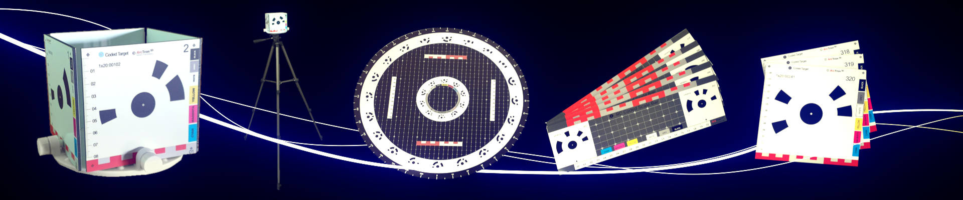
Photogrammetry Accessories
manual, only works with RealityScan from Epic Games
Coded Targets / Marker in different versions
-
For faster and more precise alignment and for easy scaling
-
Works only with RealityScan (not with other photogrammetrie software products)
-
Plate Material: AluDibond semi matt surface
-
Available for recording objects in various sizes
NEW
Coded Targets for Reality Capture
- Faster, more accurate and optimized alignment
- Simplifies the registration process for complex structures
- Manual addition of tiepoints no longer necessary
- Can also be used as (ground) control points
- Improve the fusion of active and passive sensors - laser scans, photos and video frames
- Existing measurement unit aids with scaling scenes
- Automatically mark position for higher accuracy
- Produced and suitable exclusively for the Reality Capture photogrammetry software
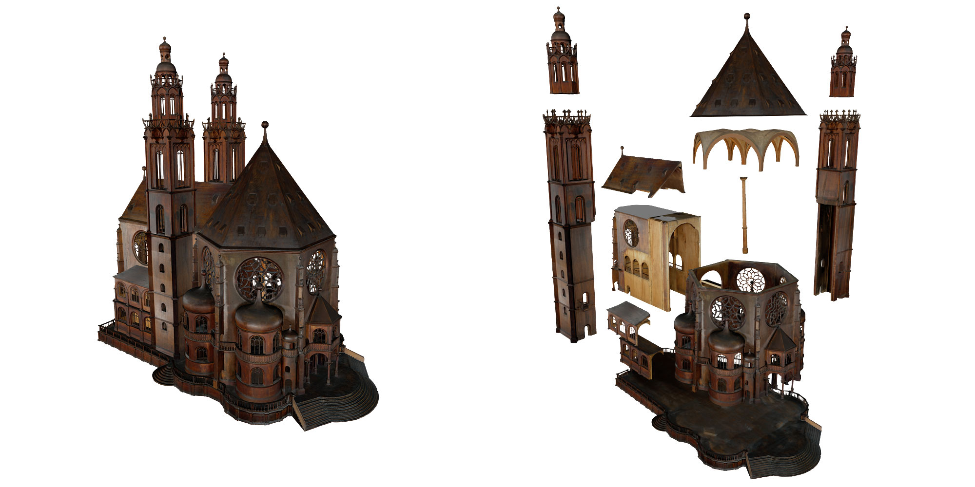
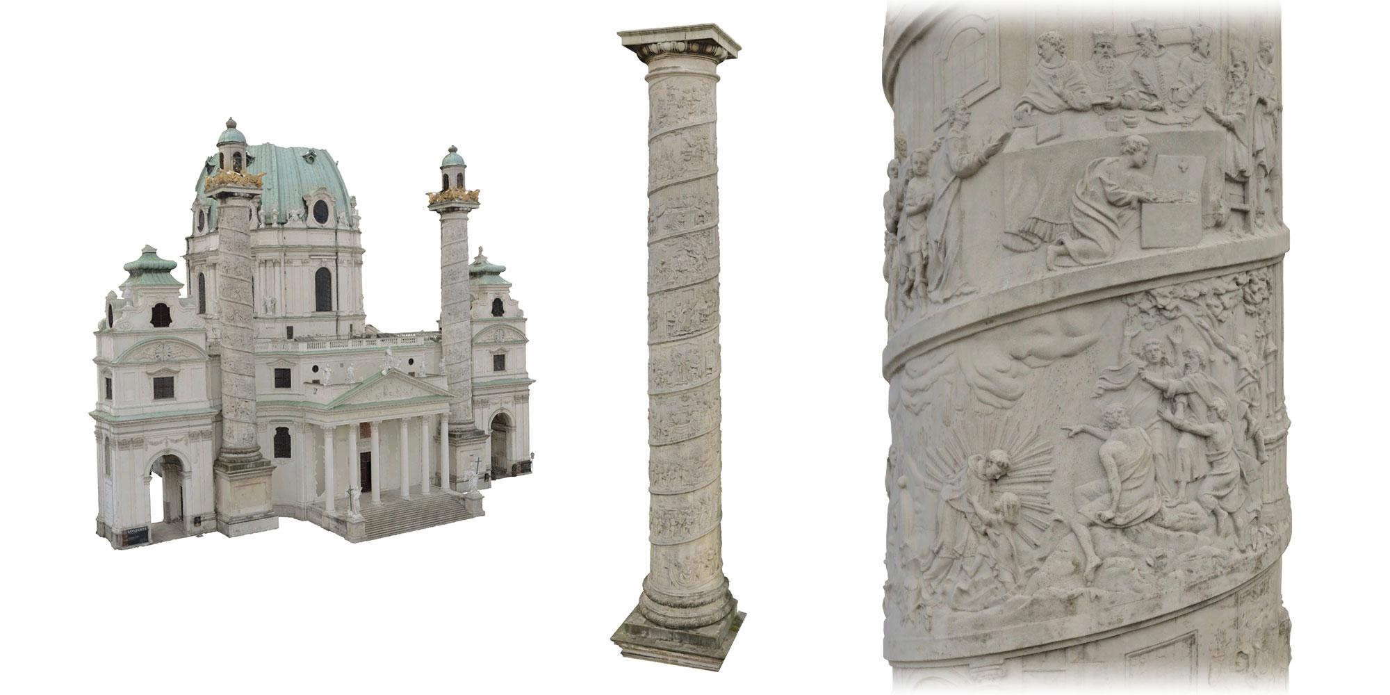
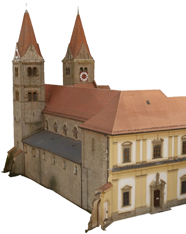
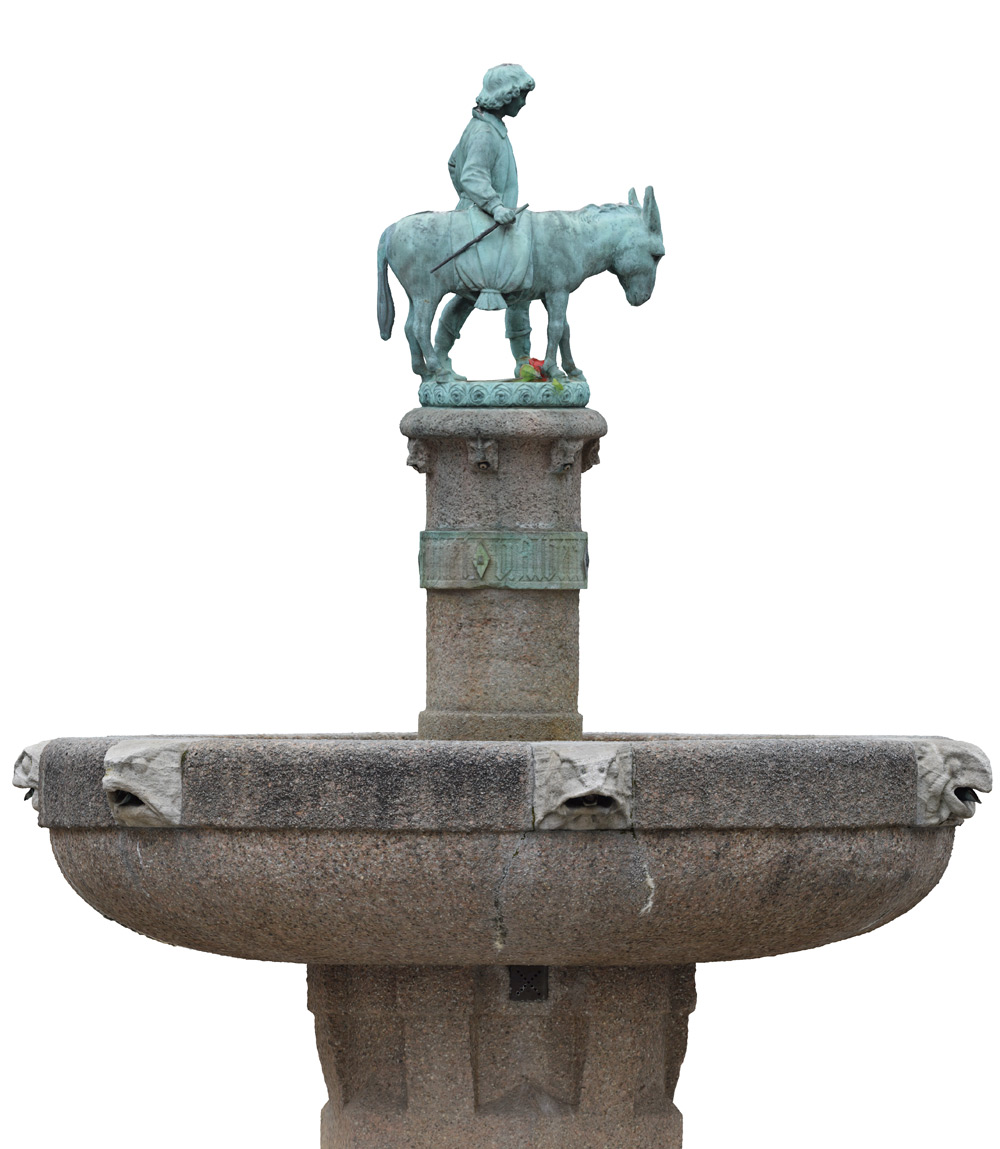
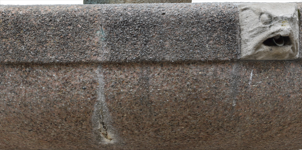
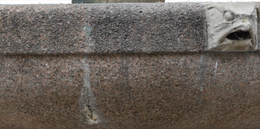
Our newest RealityScan models in project highlight
WW - II Bunkers in LØKKEN (Denmark)