- Your contact
- Martin Schaich M.A.
- +49 9408 8501 0
- info@arctron.de
- Downloads
- 3D-Scanning-Flyer
- Related topics
- 3D surveying services
With our extensive software equipment, we are able to edit almost all kinds of 3D survey data and survey images.
In the complex world of building and renovating existing buildings, accuracy, reliability and speed are crucial. Thanks to our state-of-the-art 3D laser scanning technologies, we provide you with detailed, highly accurate data at an astonishing speed. Our drone-based and terrestrial 3D photogrammetry allows us to precisely capture even hard-to-reach areas.
Our broad portfolio in 3D surveying covers the following services: from GPS-georeferenced measurement of private properties and smaller construction projects, to houses and barns, to apartment buildings and large industrial sights.
The 3D sensor technology we use can be adapted according to your specific needs in the cm, mm or even sub-mm range to guarantee the highest accuracy.
Whether raw data in the form of registered 3D point clouds or a comprehensive portfolio of photorealistic 3D models, BIM models and CAD floor plans and sectional plans, we provide you with the outcome you need.
With ArcTron by your side, you can rely on the accuracy your project needs.We are more than a service provider, we are your partner on the way to successful construction projects.
We will gladly assist you with planing your project and provide you with an offer which fits your needs!
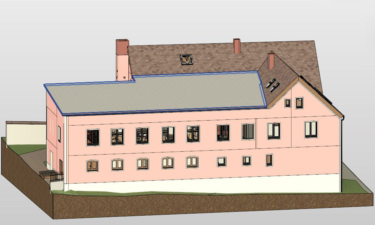
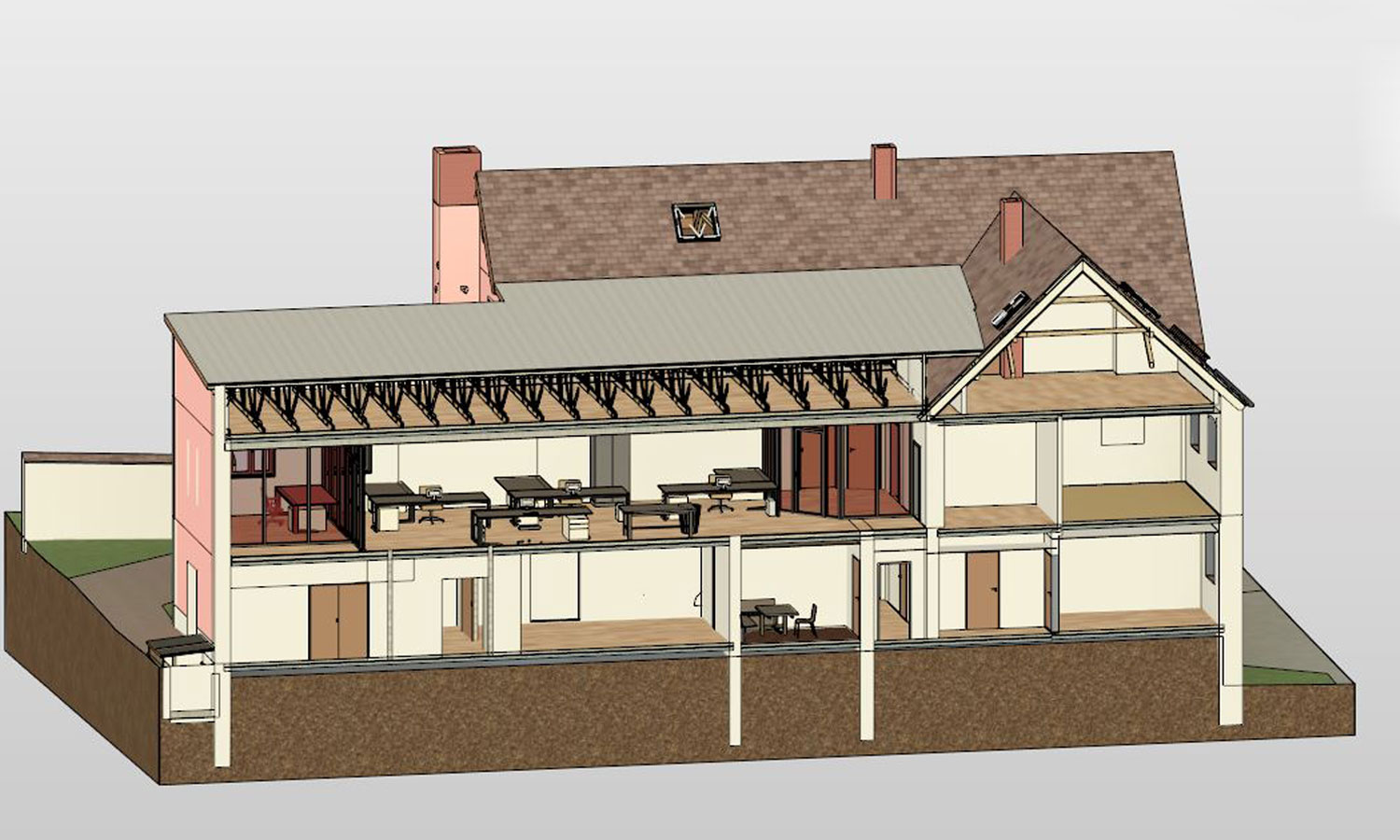
With our 3D modeling services for Building Information Modeling (BIM), you can leverage the full 3D value chain. Through our Scan2BIM solution, we seamlessly transform raw data into multi-purpose models that support project development, usage, documentation, visualization, planning, and even marketing initiatives.
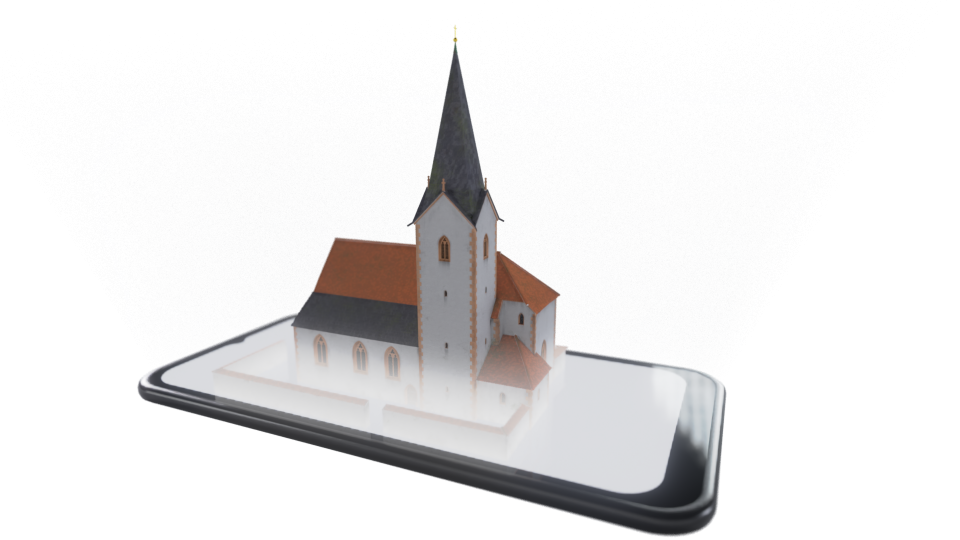
We bring your projects directly to your screen. By providing online models that are immediately accessible, we enable builders and interested parties, even without prior experience in the 3D world, to quickly and intuitively familiarize themselves with the 3D models. Discover your premises before they are realized, go on a virtual tour of your future project or present your vision in an impressive 3D representation.
Are you ready to take full advantage of 3D survey data?
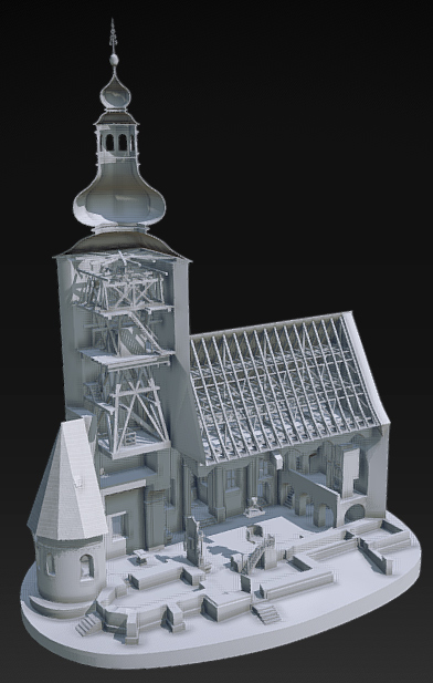
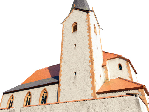
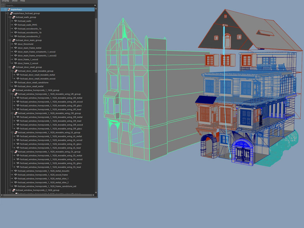
In Scan2BIM, i.e. “Scan to Building Information Modeling”, laser scan data or point clouds are converted into a Building Information Model (BIM).
In the first step, 3D data is generated using laser scanning and photogrammetry as well as drone flights. Information about the geometric shape and position of the scan objects flows into the resulting point cloud.
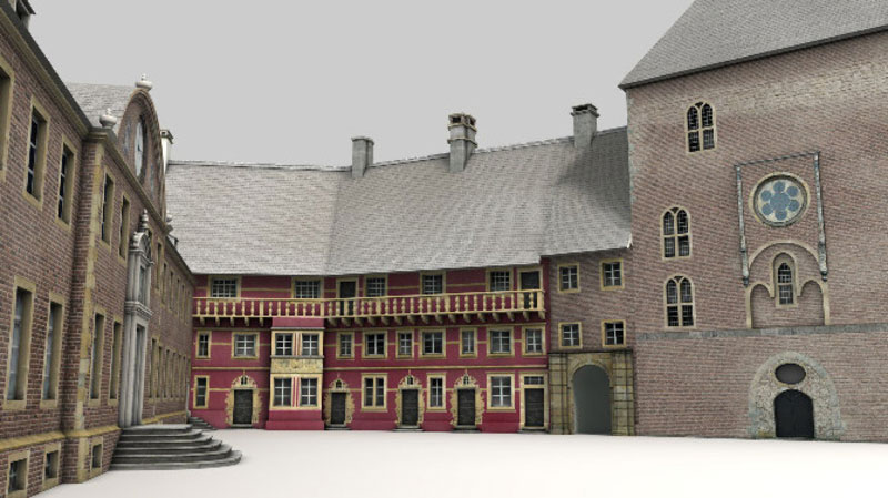
The resulting 3D model is used in architectural design, for conversion or renovation projects or even in facility management.
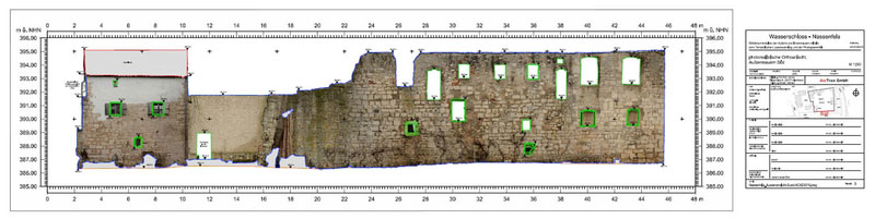
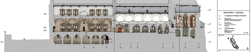
In a further step, 3D models can be converted into CAD data, provided with geometric vector graphics, which are then imported into CAD programs and further edited. Scan2CAD is used in architecture, mechanical engineering, electrical engineering, and graphic design.
The Scan2BIM2CAD process provides you with efficient tools for further processing and use of 3D models in various fields of application.
As a special service for architects and presentations, we bring your projects to life with innovative 3D printing technologies. Create complex, true-to-scale models and enjoy the freedom to assemble and disassemble your models from the basement to the roof.
Illustrate your visions, present your ideas, and wow your audience with detailed, realistic 3D prints.
But we go even further. With our augmented reality solutions, we transform your 3D-printed models into interactive information carriers. You want to add information about gross areas, usage options or the possible interior design with furniture? No problem. We add all the data you need to your model, turning it into a powerful tool for presentations, planning and decision-making.
Let your 3D-printed model become an exceptional information carrier that honors the past while shaping the future. Make complex plans tangible, visualize your vision and increase the engagement of your customers, partners and investors.
With our extensive software equipment we are able to prepare almost all 3D measurement data and measurement images according to your wishes and to realize even extensive projects in a timely manner.
Our evaluation range covers: